Unravelling the mysteries of multiple Kisdon place-names

This section from the Bartholomew half-inch map, Great Britain Series, Sheet 35 (1942), shows the three best-known Kisdon place-names – a waterfall, a hill, and a farm. Map reproduced with permission of the National Library of Scotland https://maps.nls.uk/index.html.

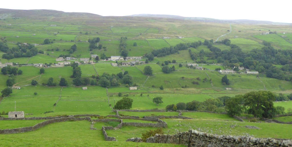
Kisdon in upper Swaledale is best-known as the name of a distinctive, isolated hill. But it’s also the name of several other topographical features to the east of it. So, which was the original Kisdon and what does it mean? It’s a difficult puzzle, but there are clues to be drawn from early records of places with similar names and from the similarity of their landscapes. By clicking here – Kisdon – multiple place-names – you can read a summary and conclusion from a detailed investigation, or in the same place you can download a pdf containing a lengthy article exploring how the most likely possibilities were considered and whittled down.

Posted in Swaledale place-names | Tagged , , | 1 Comment

How Feetham preserves an Old Norse word and an obsolete form of Old English grammar

The village of Feetham, Swaledale, shot from the opposite side the dale, and showing below it the extensive riverside grassland or meadow that might have given rise to its name.

Historic documents confirm that the village of Feetham in Swaledale developed from a 13th-century cattle farm called Fytun. But what was the meaning of Fytun and how did the name evolve to become Featham? It’s a slightly complicated but explainable story that reveals the survival of an Old Norse word and an obsolete form of old English grammar. See the whole story here: Feetham

Posted in Swaledale place-names | 1 Comment

Surrender Bridge is not the site of a military capitulation

Surrender Bridge in Swaledale

There is a myth in Swaledale that Surrender Bridge, on the lonely moor road between Feetham and Arkengarthdale, is so named because it is the site of some long-forgotten military capitulation. But logic dictates that it is named after the adjacent moor of Surrender Moss, a damp peaty expanse named almost certainly from the Old English word sūr, sūran meaning ‘sour, damp, course’. For the full explanation see here – Surrender Moss.

Posted in Swaledale place-names | Tagged , , , | Leave a comment

A field called Trews was a haunt of devilish goblins

Footpath crossing Trews
Footpath crossing Trews with its unusual rocky mound on the downward slope.

A review of a curious field in Gunnerside Gill, recorded in 1844 as Trews, has shown that its strange name probably refers to a long-forgotten belief that a large, eerie-looking, rocky mound in the field was inhabited by a group of devilish goblins – called trows.

New information about beliefs in these mystical and troublesome beings has promoted the folklore idea as the most plausible explanation for the name. In the process of research, it has been discovered that between 1844 and 1962 the field was farmed by at least six generations of one family. For the full review, see here: Trews

Posted in Swaledale place-names | Tagged , , , | 2 Comments

Finding Hodic and Stainburghanes

The view southwards at Harkerside’s western dyke, running from bottom left to top right, and now identified as ‘the great fosse called Hodic’. (Photo Author)

Two of Swaledale’s lost places – an ancient dyke called Hodic and a Romano-British or early medieval settlement called Stainburghanes – have been located by this writer using a combination of place-name research, map studies and ground observations.

As communicated in my last blog, the findings were written up in the paper ‘Grinton-Fremington Dykes; Names, Places and Spaces’, which was published online in September 2020 in the peer-reviewed academic journal Landscapes, vol. 20, no. 1. The print edition is now also available.

For this web site I have divided and slightly amended the paper to appear as two stand-alone articles. The first focuses on Hodic and Stainburghanes, while the second takes a more expansive view of four dykes combined, including the suggestion that fields called Hurrack Raine and Jenny Raine were named after the dykes that border them: raine having a meaning of ‘boundary strip’. The two articles can be found here:

Finding Hodic and Stainburghanes

Grinton-Fremington Dykes: defensive system or land boundaries?

Posted in Swaledale place-names | Tagged , , , , , | Leave a comment

Grinton-Fremington Dykes: Names, Places and Spaces

A new article I have written about the Grinton-Fremington Dykes in Swaledale has just been published online by the peer-reviewed landscape archaeology journal Landscapes.

View from the top end of the western dyke in Harkerside, now identified as 'the great fosse called Hodic', which was mentioned in a land-boundary description in an 800-year-old charter of Bridlington Priory.
View from the top end of the western dyke in Harkerside, now identified as ‘the great fosse called Hodic’, which was mentioned in a land-boundary description in an 800-year-old charter of Bridlington Priory.

Access to the finished article is normally available to subscribers of the journal only, but the publishers also allow a limited number of free downloads available to anyone. At today’s count only seven of the allocated free downloads remain available. Followers of this blog interested in reading the article should not delay in accessing a free copy by clicking this link:

https://www.tandfonline.com/eprint/ACA4YDYDAJTYNZHRXARU/full?target=10.1080/14662035.2020.1802133

The article, or ‘paper’ as the academics like to call it, presents, through the application of place-name interpretations, map studies and ground observations, a non-archaeologist’s exploration of new areas of interest that can expand our understanding of the structures and their environment.

It reveals a case of previous mistaken identity, attributes an unlocated twelfth-century name to a previously surveyed but until-now nameless ancient settlement, and identifies a potentially lost ancient burial site. It also draws evidence from the names, places and spaces around the dykes to raise new questions over the reasons for their location and construction. It might reinvigorate the previously unpopular idea that the dykes could have been built as land-management boundaries rather than as elements in a system of political defence.

Posted in Swaledale place-names | Tagged , , , , | 2 Comments

Probing the enigmatic Tackan Tan

The county boundary looking into Yorkshire, with Summer House Hill on the left and behind it Tan Hill and the roofs of Tan Hill Inn.

The county boundary looking into Yorkshire, with Summer House Hill on the left and behind it Tan Hill and the roofs of Tan Hill Inn.

The meaning of the name of Swaledale’s Tan Hill – famous for being the location of England’s highest inn – is so-far unknown, but even more mysterious is another place-name just three-quarters of a mile to the north-west named on Ordnance Survey map OL19 as Tackan Tan.

The map gives no clue to the nature of the feature named Tackan Tan. In fact it’s a lost ‘mound’ that has been replaced by road signs marking the point where the road from Tan Hill to Brough crosses the ancient county border between the North Riding of Yorkshire and Westmorland, now Cumbria. Tackan Tan has been recorded as a very important boundary marker around here since at least the 1100s. But what does this very old, rare and obscure name mean? Read an investigation here.

Posted in Swaledale place-names | Tagged , , , | Leave a comment

The Stang – a misplaced place-name

The road up The Stang in Arkengarthdale.

The road up The Stang in Arkengarthdale.

The road heading out of Arkengarthdale in the direction of Barnard Castle is a bleak moorland route that climbs up a hill or ridge known by the curious name The Stang.

Place-name experts have known for a long time that stang is derived from an Old Norse word stöng ‘a pole or post’. Research by a northern-based scholar has shown that its appearance in hundreds of place-names in Nordic-speaking countries, including many in the Nordic-influenced area of northern England, suggests a variety of interesting early applications of the core meaning. Another place-name scholar’s slightly skewed understanding of The Stang in Arkengarthdale has been caused by an error on the current OS Explorer map, which puts the name in the wrong place. The full explanation is here.

Posted in Swaledale place-names | Tagged , | Leave a comment

Hugh Seat – a mountain named after a murderer

Hugh Seat viewed from Eden Valley in the parish of Mallerstang

Hugh Seat viewed from Eden Valley in the parish of Mallerstang

At 689 metres (2,260 ft.), the summit of Hugh Seat marks a point on the parish and county border between Muker in Swaledale, North Yorkshire, and Mallerstang in the Eden Valley, Cumbria.

It is remarkable in that the great rivers of the valleys it divides both spring from its slopes – the north-west-running River Eden and the east-running River Swale, for which reason the mountain has been known in the past as the ‘watershed of England’. It is one of the highest peaks anywhere along the Pennine ridge, and is adjudged the tenth highest mountain in the Yorkshire Dales.

Even more remarkably, it is named after a notorious 12th-century murderer – the nobleman Hugh de Morville, who was one of the four knights who slaughtered Archbishop Thomas Becket in Canterbury Cathedral in 1170. The full story of the name Hugh Seat can be read here.

Posted in Swaledale place-names | Tagged , , , , , , , , , , , | Leave a comment

A field-name story of bowls, tups and bulls

Bull Alley - originally Bowl Alley - alongside the lane at Muker.

Bull Alley – originally Bowl Alley – alongside the lane at Muker.

The excellent web site of the Farmers Arms at Muker describes a fine circular walk from the pub that incorporates a stroll along a lane called Bull Alley www.farmersarmsmuker.co.uk/muker-circular. The origin of the name seems to have nothing to do with bulls, but everything to do with the ancient pastime of bowls. Meanwhile, the adjoining field, also called Bull Alley, is best known for its interesting role in the history of Swaledale tups. See the full story here: Bowl Alley (now Bull Alley).

Posted in Swaledale place-names | Tagged , , , | Leave a comment